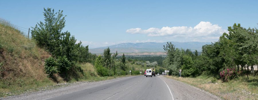
After cycling in the mountains for several weeks, today was the first time since Uzbekistan where I was cycling in the flatlands again. This part of Kyrgyzstan resembles Switzerland’s middle part a lot: it’s green, lots of trees, water, fields, and some small hills. Cycling through this part on the one hand convenient because no big climbs occur, on the other hand the scenery is also not as spectacular as in the mountains. To get started again after my two day break in Osh however, it was perfect.
Traffic chaos in Osh
When I left Osh this morning, there was quite a traffic chaos in town, and because drivers of cars here don’t realize that it might be nice to leave some space for bicycles, I was partially also stuck in the traffic jam. It took me almost half an hour to leave the city and its traffic.
Finally on the road
Today’s goal is Jalal Abad, Kyrgyzstan’s third largest city. It will be the gateway to some more cycling in the mountains in the coming days. Jalal Abad is not that far away on the map, however, because the direct line between the two cities leads through Uzbekistan (thanks to the Russian setting the border like this), the trip will be around 110 km today. Luckily, the road is very good, except the first few kilometers after Osh. Unluckily this is the main road between the capital Bishkek and Osh, with means there is a lot of traffic, making cycling on the same road less enjoyable. At least the green scenery as well as the moderate temperatures (25°C) were pleasant.
Snack at gas station
After 40 km I saw a nice gas station with cool coke in a fridge. So I left the road to get one. When I finished drinking it, the gas station owner invited me for a tea. Since I had enough time, I agreed. But then he continued offering me food (bread, sausage, noodles). It was very cute of him, but I really did not want to eat too much, first because I wanted to have lunch later, and second because I was basically eating his lunch. So I had a few bites and then continued.
Shortcut with consequences
On this trip I discovered the App “maps.me”. It is a kind of Google Maps, but works fully offline, very convenient for countries like the ones I visited. It also has a navigation feature built in. When I was reaching the small town of Ösgön, maps.me showed me a shortcut which saves me a few kilometers by using some local roads and then a small bridge over the river. I thought, why not, and gave it a try.
5 km down the shortcut road, a car that was crossing me suddenly stopped and was waving his hands. The guy tried to tell me that I could not continue towards Jalal Abad this way. I was a bit confused, because there was a clear road on the map, and even the satellite image of Google Maps showed a bridge over the river. After asking two more locals however, I realized that the bridge must be damaged and therefore I had to go back to Ösgön and take the long route. The positive side of the story is, the detour was leading through beautiful rice fields, so it was not only wasted time.
After a short lunch in Ösgön I followed the main road until close to the spot where the bridge was drawn on the map. Curious as I am, I could not resist going down to the river to check if the bridge was really broken… Already when cycling those 500 m from the main road, people were waving their hands again. So I knew that the bridge indeed must be broken. And a few minutes later I also got visual confirmation. I was really glad that I listened to the locals before lunch, otherwise I would have done another 10-15 km for nothing.
Reaching Jalal Abad
Shortly before Jalal Abad, maps.me was showing me another shortcut. I thought I give it a second chance today, and was lucky, this time the shortcut worked and saved me at least 5 kilometers of cycling. One I reached Jalal Abad, I checked into one of the many homestays and had a decent dinner there.
Tomorrow, I will have to check in town whether the intended road through the mountains is actually open. I heard some people saying today that it was blocked due to landslides. I will know more tomorrow…
Detailed Track
Max elevation: 1135 m
Min elevation: 759 m
Total climbing: 1720 m
Total descent: -1871 m
Total time: 08:38:41


