My first impression of Kyrgyzstan was a muddy road that lead down from a pass on 4300 m to Sary Tash, which again was on 3200 m and hence the vegetation is very sparse and the climate is harsh.
Today I had to cross two more passes of around 3600 m of altitude to reach the lower regions of Kyrgyzstan, and the more I descended towards Gulcha at an altitude of 1600 m, my target city today, the more trees, green areas, and animals I met.
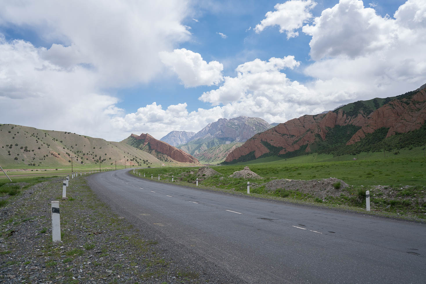
Climb in the morning
When I left Sary Tash in the morning, I immediately started climbing the first of the two passes. As it was still at a high altitude and early in the morning, it was quite chilly, especially with the wind blowing over the pass near the top. However, the sun is also intensive and compensated a bit for the wind.
Having reached the first pass, there was a steep descent for around 2-3 km, and then the next climb started. They really could have built that road somehow that I don’t have to descent and climb in such short intervals. After in total 2 hours in total, I also reached the second pass, and a long descent was ahead. As the clouds over the high mountains already got dark at that time and rain was imminent, I was glad I could descent and run away from the clouds.


Unfriendly welcome by local boy
In Sary Tash, I did not meet lots of people as it is only a transit place, so the first encounters with locals I made on the way down from the second pass. And somehow especially the boys seemed unfriendly and also aggressive. When going downhill at a high speed, two boys who were standing on a hill next to the road were throwing rocks at me, one hit me at the arm. Fortunately I was not hurt, but if he had hit my face 10 cm more up, it would have hurt. As I was going down fast, I did not stop and teach him a lesson, but I probably should have.
After this incident, I met other boys who were quite unfriendly, but at least not violent. I hope this was the last incident of this kind.
Descending to Gulcha
From the nature point of view, the descent was nice. I was cycling through red canyons covered with green grass, through small villages, and dozens of animal herds that were moving towards the mountains with their farmers. At times, it was quite difficult to get through a few hundred sheep or dozens of horses who were occupying the road. While the sheep are weaker than me and move to the side normally, with horses I had to be a bit more careful.


Evening in Gulcha
Gulcha is a nice little city, and it was the first occasion to organize e.g. a local SIM card, find some decent shops, and chat with some people outside a bank. People here were in a good mood, the police officers were interested in my bike and were joking about taking my helmet, I get their police uniform hat instead.
I found a place to sleep in a homestay. I was the only guest, and I could use their kitchen, so I started cooking some of the conserved stuff that I bought for the Pamirs for emergency situations. And after that, I finally had time again to update my blog. It is the first time since Khorog and for about two weeks that I have a decent Internet connection again.
Tomorrow I will continue to Osh, the second largest city in Kyrgyzstan. For that, I will have to climb another 800 m and then basically roll down for 60 km.
Detailed Track
Max elevation: 3600 m
Min elevation: 1648 m
Total climbing: 1028 m
Total descent: -2566 m
Total time: 07:59:02