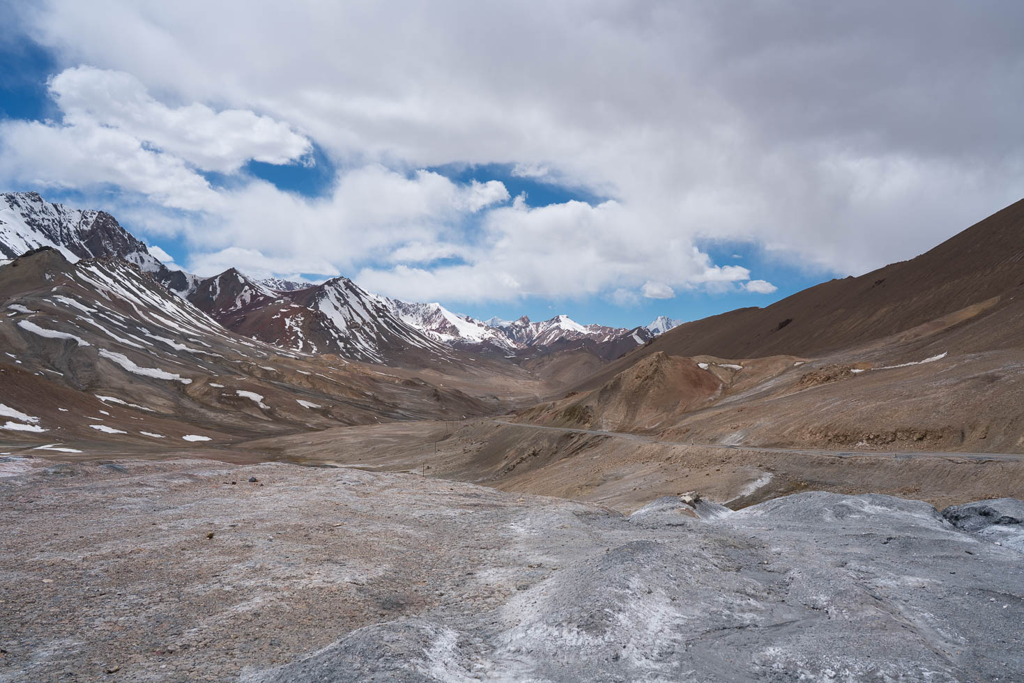
There are quite a few high passes on the Pamir Highway, the highest of them is Ak-Baital Pass at an altitude of 4655 m. It connects the city of Murghab with the plateau of Karakul, a salt lake that was formed after a meteor strike. Today I crossed this pass and reached the village named Karakul, the last village before the Kyrgyz border and at the same time the first village after Murghab. Even though being acclimatized, it was a big challenge for my body to get my heavy bicycle and me over the pass due to the altitude.
Continuing my trip on my own
I met my travel partners Lucie and Anne over an Internet platform called warmshowers.org and we chose to travel together because we share the same route. If it works out from the personal point of view is another question and this is only answered once travelling together. While I got along very well with Lucie travelling through Iran, things got more complicated once Anne joined in Uzbekistan. Anne and I had very different personalities and our motivation for this bicycle trip was also very different. For me, the goal was to experience as much as possible, enjoy nature, and also have moments of silence, especially in the evenings. Together with Anne this was impossible.
Also, due to poor choice of equipment and overestimation of her fitness, Anne’s travel speed especially in mountainous regions was much slower than mine and made me wait for more than two hours each day. This made travelling together more frustrating than a pleasure. Therefore I decided to continue my trip alone and let Lucie and Anne travel together independently, also because Lucie seems to like Anne’s way of travelling more than mine. It is the best solution for all involved people.
Lonely part of the Pamir Highway
Now back to my trip: At Murghab, trucks leave the Pamir Highway in order to take a pass into China. This leaves very little traffic for the part of the Pamir Highway north of Murghab. The remaining traffic consists mainly of 4×4 vehicles and motorbikes of tourists, and some isolated cyclists like me. In the first three hours since I started cycling at 7:00 I did not meet any vehicle at all on the way and I had the beautiful and desert-like landscape all to myself (and some marmots, Yaks, and an Eagle). During the whole day I only saw roughly 10 vehicles. This was really enjoyable, especially the silence in these remote valleys.


Cold feet in the morning
My cycling day did not start so well, because one of the bridges over a small river was broken. While this is not a problem for motorcycles and cars which simply drive through the shallow waters, for cyclists with the bags attached very low and the pedals also only a few centimeters above ground, this meant taking off your shoes or getting them wet. So I did and started pushing the bicycle and carrying the bags through the ice-cold water that originates from some snowy mountains. Even though I was at most one minute in the water with my feet, they still felt cold 2 hours later. Luckily, all other bridges were in good shape.


Climbing up Ak-Baital Pass
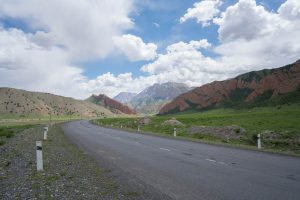
From Murghab, the total climb to the top of the pass is around 1000 m, spread almost steadily over 75 km. And except the last 3 km, the road was in an excellent condition, making the climb very efficient. The last part of the road before the pass was not paved, but also not technically difficult. What caused me much more difficulties was the altitude. The higher I got, the slower I climbed, and shorty before the pass I basically climbed 10 meters and then had to take a rest for half a minute. I did not feel any symptoms of altitude sickness, however I felt that the body just lacks oxygen. For that reason the last 3 km of the pass took a lot more time than expected, but finally after a bit more than 5.5 hours since my start in Murghab I was on top of the pass.


Descent to Karakul Village
What followed the climb was a planned 55 km descent to Karakul village. I was looking forward to that, as it is my reward for the tedious climb. However, soon after starting the descent, the road conditions got really bad. First only some holes in the road and loose rocks that I could cycle around, but later on in the flatter parts the typical bumps in regular intervals of around 30 cm (in German: “Wellblechpiste”) across the whole width of the street, making it impossible to avoid them. Cycling over these bumps is very annoying as you cannot accelerate properly with the bicycle and everything is shaken through. Only 20 km after the pass the road was paved again and allowed cycling at a normal speed. In addition to the difficult road conditions, I also had strong head wind for almost the whole day, reducing the fun even more.
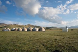
I was not sure in the morning if I will reach Karakul village because the total distance is more than 130 km and there was this high-altitude pass in between, but it was the first village after Murghab, and also where there is a homestay, so I set this as an ambitious goal for today. In between there were just some isolated buildings of farmers and some ruins.
Having wasted a lot of energy on the pass and the terrible road afterwards, I really doubted at times to still reach Karakul. But the perspective of sleeping in a warm room with a decent dinner kept me cycling completely exhausted for another 35 km and I reached Karakul shortly before sunset. The alternative would have been to sleep in a tent on above 4000 m at freezing temperatures between the highway and the Chinese border fence in a rocky and windy environment.
I was really glad I was travelling alone today. If I had still traveled in the group of three, I would have never reached this goal and most likely I would have had to camp even before the pass.


Plan for tomorrow
Tomorrow I plan to exit Tajikistan via two passes north of Karakul. However, the weather forecast for tomorrow is not good at all, so I will decide tomorrow morning if I actually will do it. The perspective of getting trapped in a snow storm on a mountain pass between two countries (the border posts of the two countries are 20 km apart, also known as “no-man’s-land”) is not so tempting.
Detailed Track
Max elevation: 4659 m
Min elevation: 3664 m
Total climbing: 1657 m
Total descent: -1332 m
Total time: 12:29:33