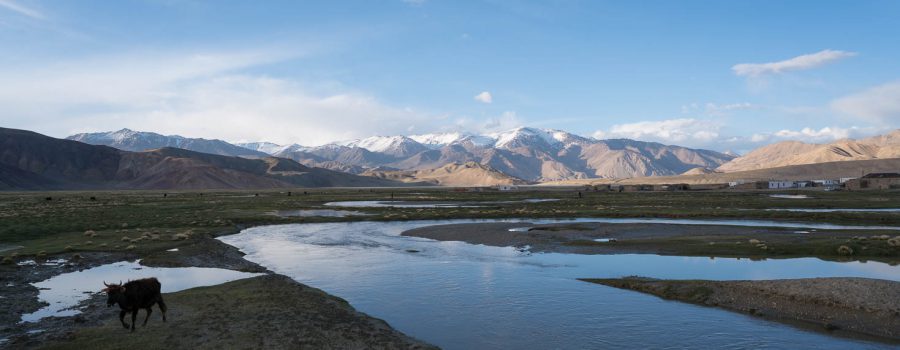
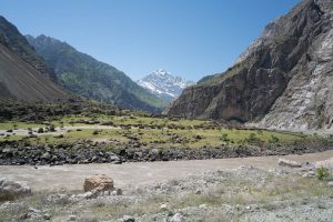
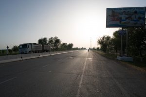
For more than two weeks we have been following the Tajik-Afghan border. Today it was time to say goodbye to Afghanistan as we were heading north over the 4344 m high Khargush Pass in order to reach the M-41, also known as Pamir Highway. After that we planned to go to Bulunkul, a lake and a village with the same name. In the end only I arrived at Bulunkul, I don’t know exactly where Anne and Lucie stopped.
Goodbye Afghanistan
When people hear about Afghanistan, they immediately think of Taliban, the IS, bomb attacks, and the critical security situation as it is continuously presented by the media. While these reports are undeniably true, there are also regions in Afghanistan where it is peaceful. And these are the regions that we have been following.
Even though there was a very high military presence on the Tajik side, mostly to fight drug trafficking, we did not encounter one single situation where we felt unsafe or where we had the feeling that on the other side of the river bad things are happening. On the contrary, we saw farmers all along the way doing exactly the same things as their counterparts on the Tajik side: Farming. They also were very friendly and happy to see us pass, even though the river separated us.
Today, we leave the Afghan border and head inland.
Khargush Pass
We already crossed a few passes on our cycle tour, but none of them was higher than 2700 m. With its 4344 m, Khargush Pass is a real test. We started the climb early in the morning in perfect weather from last night’s sleeping place in Khargush on 3900 m. Surprisingly, the road up to the pass was in a very good condition as compared to the previous two days where we had to fight with the worst imaginable road conditions for cyclists. We managed the 400 m climb in less than two hours and after a short break we were looking forward to descending to the Pamir Highway.
But the negative surprise started soon after the pass: The road conditions on the other side of the pass were partially very bad: Long sand stretches, bumpy and rocky roads, and mud. Instead of descending relaxed and in a decent speed, the descent was challenging material and body and after tedious 20 km I finally reached the Pamir Highway, which was paved.


Race against the upcoming storm
In the past few days, we usually cycled at our own pace, meaning that Anne and Lucie cycled together (even though Lucie could easily keep up with me) at a slower pace because Anne had to push her not-so-optimal bike for the Pamirs through most of the sandy or steep climbs. I usually went ahead and waited from time to time for the girls to catch up.
Today, we did this the same way, and it also worked fine on the top of the pass. However, when I reached the Pamir Highway, there was no sign of Anne and Lucie, even after waiting for an hour. As a big storm was coming up, I had to do something because I was basically in the middle of nowhere without too much water left and a hungry stomach. So I decided to continue on my own to our target Bulunkul in order to arrive before the storm hits me.
As already experienced in Khorog, it can go very quickly until a big storm is formed here in the Pamirs. Compared to my experience in Khorog where there were farm buildings every 1 km to look for shelter, here on almost 4000 m there are no buildings within 15 km. So I cycled as fast as possible over again partially very bad roads towards Bulunkul, and also directly towards the big storm. I already had a very strong head wind and ten minutes after my arrival at a homestay in Bulunkul at roughly 14:00, the visibility went to almost zero due to the storm blowing around sand in all directions. I was very exhausted and had a decent lunch at the homestay. I definitely won’t forget this adventure. If I had not made it to the homestay in time, I would have had to set up my tent in the middle of nowhere to protect myself from the chilly wind, sand, and snow.
Unfortunately, Anne and Lucie did or could not follow me to Bulunkul. I hope they made it safely to Alichur.


Beautiful Evening
The storm raged for at least two hours, but after that the sky cleared up, so I took my bicycle and cycled up a hill west of Bulunkul village, from which Bulunkul Lage and also the larger Yasilkul Lake can be seen. It was chilly, but very beautiful to watch the weather changing between clouds, sun, and snowfall.


Detailed Track
Max elevation: 4309 m
Min elevation: 3771 m
Total climbing: 1096 m
Total descent: -1224 m
Total time: 11:19:20


