Today we had another full day in Khorogh due to Anne’s recovery from her stomach problems. As we have seen the city already yesterday however, it was a perfect occasion for a day trip. While Lucie preferred running up some mountain, I chose to explore the Shakhdara Valley on my bicycle. Because I could leave all my bags in the hostel, I was travelling very light for once.
About the Shakhdara Valley
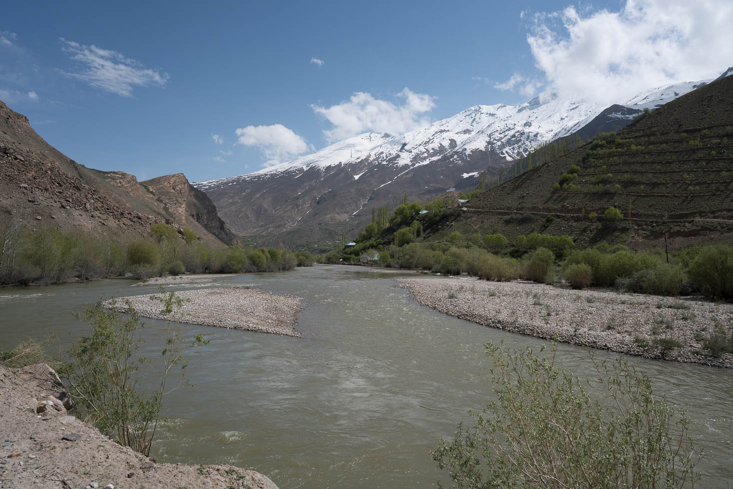
As compared to the Ghund Valley in the north where the Pamir Highway runs through and the Wakhan Valley in the south, there is nowadays no transit in the Shakhdara Valley due to a destroyed bridge. So cycling in Shakhdara Valley means going into a dead-end, but luckily a beautiful one. It also means that there are far less foreigners entering this valley.
The valley itself is around 160 km long, which of course was too much for me on the bicycle on one day, but I managed to get 50 km into this beautiful valley and climb up to 2800 m. On the way I got to see dozens of nice mountains, rock faces, and a few glimpses on some of the 6000+ m peaks in this part of the Pamirs.


Unpleasant weather surprise
As in the morning the weather was perfect, I decided to go with a T-Shirt, shorts, and sandals. In sunny weather, this is perfectly fine because the sun is very strong up here. After climbing up 40 km along the valley road however, when looking back to Khorogh, the sky looked very dark there. At my current location however it was still wonderful weather. As I assumed that it’s already raining in Khorog anyway, I continued another 10 km, accompanied by a tail wind towards the blue sky. But the bad weather caught up with me much faster than expected, and at kilometer 50 when I decided to turn back towards the last village, I had a very strong wind blowing first sand, later on also rain into my face. Being dressed in a T-Shirt only, this was very chilly on 2800 m, so I quickly went looking for shelter at a farmer’s house.
After 15 minutes, the storm however was already over again, the sun came out, and it looked like if nothing happened. Even though I was never really in danger because there were farm houses every few kilometers to find shelter, I still was very surprised how quickly the weather changed from excellent to horrible and back to excellent again. I will keep this in mind for the future ascent into the high altitudes of the Pamirs.


Returning to Khorog
After the storm I decided to cycle back as quickly as possible to Khorog, because I assumed there will be more storms coming. However, I still had 50 km and 600 m to descend on a very bumpy road, and around 20 km before Khorog I saw black clouds over Khorog again. I hurried up a little and this time I made it right in time before the next rain started back to the lodge. After 100 km of cycling on bad roads it is time now for a decent dinner. Tomorrow, we plan to continue south towards Ishkashim in the Wakhan Valley, our south-most point in Tajikistan.


Detailed Track
Max elevation: 2817 m
Min elevation: 2120 m
Total climbing: 1434 m
Total descent: -1446 m
Total time: 06:33:12