The Pamirs cover the largest part of Tajikistan and are located in the eastern half of the country in the autonomous region of Gorno-Badakhshan. From Dushanbe it is roughly 500 km to reach the Pamirs, so today we did the first part of this journey. My back pain got a bit better, but it is still far from being gone. But it was possible to cycle around 70 km.
Southern Route to Pamirs
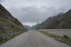
There are two routes that lead to the Pamirs. The first one, the M-41, leads over the Saghirdasht pass (3252 m) and is more delicate to cycle because of its altitude. Especially in spring and after the rainfalls in the past few days, there is an increased risk of the road being blocked by either landslides or avalanches. Therefore we decided to take the southern route, the A-385. The highest elevation on that road is only around 2200 m and it is also the road that is nowadays taken into the Pamirs by most of the motorized traffic. In addition, the A-385 is paved most of the way, making progressing easier.
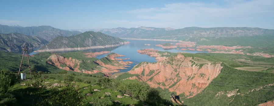
I cannot say anything about the northern route, but the scenery on the southern route started was very beautiful. In the background we could always see the peaks of the Fann Mountains that we passed earlier, and after 40 km we reached Norak Reservoir, an artificial but very beautiful lake. Unfortunately the lake itself was not very accessible for swimming, but it was still nice to see it in the evening sun.
On the map, the route looked quite flat, but in fact it is quite hilly in these region making us climb on bicycle again and again, in total more than 1000 m. Together with temperatures at around 30°C, that was not always easy. Nevertheless, the hills were very beautiful and offered nice views on Norak Reservoir.


Staying on a farm
When we wanted to set up our tents close to a small village, a farmer invited us to stay at their farm overnight, so we accepted. The farmers were living in very simple conditions, as you can see in the pictures. Three generations were living in the same hut that had around 30 m2 of space. They had their own oven for bread, and bread is also the main food they eat. For dinner we had some soup with bread, the same in the morning. Their life is very simplistic and when we arrived the grandmother was milking a cow, and donkeys and chicken were roaming around.
But what was also not missing here was a TV and mobile phones. It was again impressive to see that even in the simplest places, electronic devices are available and help people making life better. The mobile phone of the grandmother was ringing several time tonight.
Our sleeping place was outside the hut next to the bread oven. It was open-air, but covered. And due to the nice temperatures here, it was actually pleasant to sleep outside. Let’s see however how well we can sleep, there are plenty of dogs barking nearby, and the donkeys also tend to communicate quite loudly.


Detailed Track
Max elevation: 1354 m
Min elevation: 667 m
Total climbing: 2435 m
Total descent: -2088 m
Total time: 09:27:54


